GPSMAP 3206/3210 Owner’s Manual 31
basIc oPeratIon > creatIng and usIng routes
basIc
operatIon
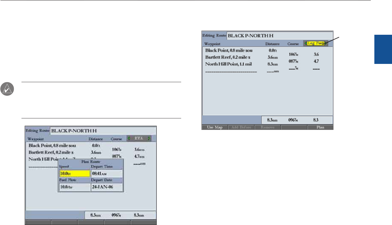
Planning Routes
You can enter information on the Plan Route window, such as your speed,
departure time, fuel ow, and departure date so your GPSMAP 3206/3210 can
estimate information about your trip.
To plan your trip (route):
1. PressthePlansoftkeyontheRoutelisttoopenthePlanRoutewindow.
2. Enterplanningdataforspeedandfuelow.Youcanalsoenterthedate
andtimeofyourdeparture.Asyouenterplanninginformation,theeldson
theRoutelistareautomaticallycalculated.
NOTE: Fuel ow rates are measured in units per hour. System setting changes
for units of measure (statute, nautical, or metric) do not affect the fuel ow
measure. You should enter fuel ow rates based on available information for
your boat (operators manual, performance specications) and note the units of
measure (gallons, liters, and so on).
3. PressQUITtoreturntotheRoutelist.
To change the data column (Plan Route feature):
1. OntheRoutelist,highlighttheadjustmentbuttontotherightoftheCourse
columnheader,andpressENTER.Themiddletitleishighlighted.
Planning
features
2. PressleftorrightontheROCKERtoselectoneofnineavailableplanning
features,includingETA(EstimatedTimeofArrivalatpoint),Fuel(topoint),
Leg Dist,Leg Fuel,Leg Time,Sunrise,Sunset(atpointlocation),and
Time To(point).
Theunitautomaticallyrecalculateseachwaypointintheroutebasedonthe
planningfeatureselected.
3. PressENTERwhenyouarenished.


