10 | Chapter 2 Improved DWG Support
In the illustration on the facing page, the drawing file PROJECT.DWG has
three drawings attached to it: PARCELS.DWG, SEWER_DATA.DWG, and
WATER_DATA.DWG. When the the Circle query is executed, it extracts all the
data that falls within a pre-defined circle from all three attached files.
The example in the illustration is a very simple query, called a location query
because it is based on a location in the drawing (in this case, a circular area).
Queries can be much more complex than this one, with multiple lines that
include SQL statements. However, to bring data from any Autodesk Map
query into Autodesk MapGuide Author, the procedure is the same.
Creating a Layer from a Query
Use the following steps to create a new layer from a query in Autodesk
MapGuide.
To create a new layer from a query
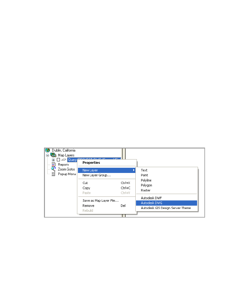
1 In Autodesk MapGuide Author, right-click Map Layers and then click
New Layer
➤ Autodesk DWG.
2 On the General tab, enter a name for the new layer.
3 Click the Data Sources tab, and make sure that the map server agent path
is pointing to the correct location.
4 Click the Data Source Browse button, and select a DWG data source.
5 Click the Autodesk DWG Browse button, and select a DWG file.
6 Optionally, select a key table and key column if you want to associate
table data with the geometry on this layer. For more information, see the
topic “About DWG Data Sources” in the Autodesk MapGuide Help.
7 For Filter Type, select Query.
8 Click the Query Name Browse button, and select a query.


