58
Getting Started
Main Page Sequence
58
Reference
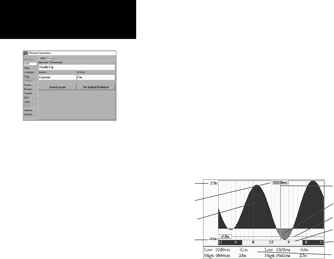
The GPS Info tab features a “Setup” submenu tab that provides access to functions and features relating
to the GPS tab.
• Skyview Orientation— allows you to select between a North Up or Track Up sky view display for
the GPS Info display only.
• Source— set to ‘Garmin’ when using a Garmin sensor (GPS 17) or to ‘NMEA’ when using any
other GPS NMEA source.
• WAAS— toggles the WAAS capability of the receiver On or Off.
The following option button only appear when the unit is not receiving satellites and set to ‘Garmin’
Source:
• AutoLocate— allows the receiver to locate your position automatically. This process can take up to
fi ve minutes.
• Set Initial Position— allows you to initialize the receiver graphically on the Map Page to initially
help the receiver acquire more quickly. See page 16 for instructions on initialization.
Tide Tab— shows a graphical chart which displays tide station information in a 24 hour span starting
at midnight. You can choose from different dates and over 3000 tide stations around the USA coastline,
Alaska, Hawaii, western Canada and several of the Caribbean islands, or more with some BlueChart data.
The top of the page displays the tide station being referenced, the distance and bearing from your
current location, and below that the date. The bottom of the chart shows a 24-hour block of local time
for your position. Daylight (yellow bar) and nighttime (blue bar) at the station show across the time scale,
GPS Setup Submenu Tab
Local Time
Day
Night
Current Time Bar
Max. Level
Min. Level
Current Tide Height Bar
High Tide Curve
Low Tide Curve
Main Menu: GPS/
Tide Tabs
Event Times


